

Wildfire Prevention & Detection
Wildfires can cause devastating damage to forests, infrastructure, agricultural land, and communities. By combining thermal drone imaging and photogrammetry, we can provide landowners, utility companies, forestry agencies, and government organizations with powerful tools for identifying fire risks, monitoring large areas, and detecting fires before they become major incidents.
Thermal Drone Imaging for Wildfire Prevention and Early Detection
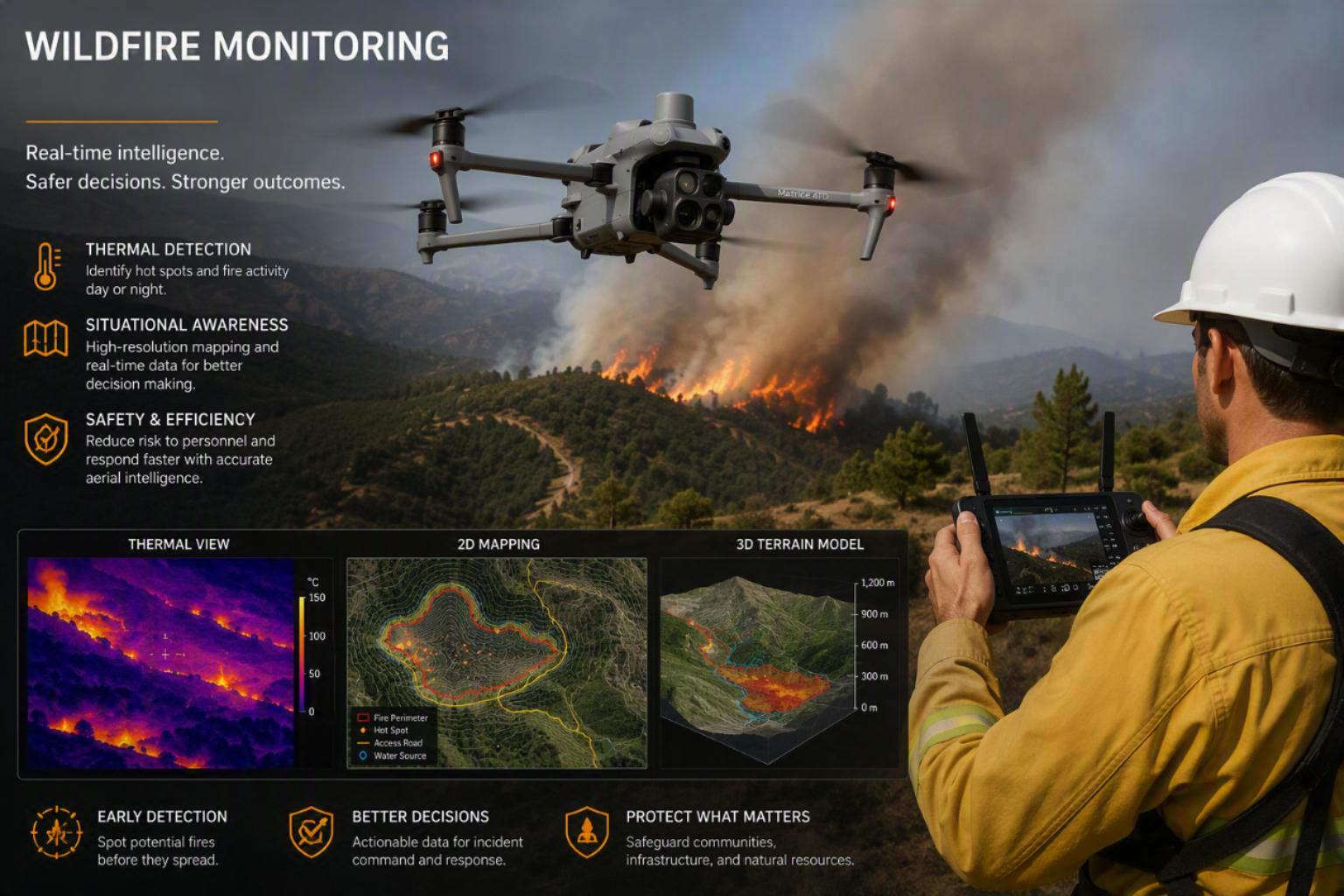
Thermal imaging drones use infrared sensors to detect temperature differences that are invisible to the human eye. This technology enables rapid identification of potential fire hazards across large and difficult-to-access areas.
Early Hotspot Detection
Thermal drones can locate abnormal heat signatures long before smoke or visible flames appear. Potential ignition sources such as overheated electrical equipment, smoldering vegetation, or underground peat fires can be detected quickly, allowing preventative action to be taken before a wildfire starts.
Utility and Infrastructure Inspections
Powerlines, transformers, substations, and electrical infrastructure are common wildfire ignition sources. Thermal inspections can identify overheating components, damaged connections, and equipment failures that could spark fires during dry conditions.
Monitoring High-Risk Areas
Forested regions, grasslands, and areas affected by drought can be regularly surveyed to identify zones with elevated fire risk. Thermal mapping helps authorities prioritize vegetation management and fuel reduction programs.
Night-Time Surveillance
Unlike traditional visual inspections, thermal drones operate effectively in darkness, smoke, and low-visibility conditions. This makes them ideal for nighttime patrols when potential fires may otherwise go unnoticed.
Active Fire Response Support
During wildfire events, thermal imaging provides real-time intelligence by locating fire fronts, hidden hotspots, and reignition risks. Emergency responders can use this information to deploy resources more effectively and improve firefighter safety.
Photogrammetry for Wildfire Prevention and Risk Assessment
Photogrammetry uses overlapping aerial images captured by drones to create highly accurate 2D maps, 3D models, terrain data, and vegetation analyses.
Vegetation and Fuel Load Mapping
High-resolution aerial mapping allows drone operators to identify dense vegetation, dead trees, dry grass, and other combustible materials that increase wildfire risk. Land managers can use this data to plan controlled burns, vegetation clearing, and fuel reduction projects.
Creation of Fire Risk Maps
Photogrammetry generates detailed maps that reveal terrain features, vegetation density, access routes, and natural firebreaks. These datasets support comprehensive wildfire risk assessments and mitigation planning.
3D Terrain Modeling
Accurate 3D models help fire prevention agencies understand how topography may influence fire behavior. Factors such as slope, elevation, and drainage patterns can significantly affect fire spread and intensity.
Access Route and Emergency Planning
Photogrammetric surveys provide detailed information on roads, tracks, water sources, and emergency access points. This allows responders to prepare evacuation routes and firefighting strategies before an incident occurs.
Change Detection Monitoring
Repeat drone surveys can compare site conditions over time, highlighting vegetation growth, accumulation of fuel loads, storm damage, and other changes that may increase wildfire risk.
The Power of Combining Thermal Imaging and Photogrammetry
When used together, thermal imaging and photogrammetry provide a complete wildfire management solution.
Thermal Imaging provides:
- Heat detection
- Hotspot identification
- Equipment monitoring
- Active fire intelligence
Photogrammetry provides:
- Detailed mapping
- Vegetation analysis
- Terrain modeling
- Risk assessment data
By integrating both technologies, we can deliver actionable insights that help organizations:
- Prevent wildfires before they start
- Detect developing fires earlier
- Protect critical infrastructure
- Improve emergency response planning
- Reduce environmental and economic damage
- Enhance public and firefighter safety
Why Choose Drone-Based Wildfire Monitoring?
Drone technology offers a safer, faster, and more cost-effective alternative to traditional ground surveys and manned aircraft inspections. High-resolution thermal and mapping data can be collected quickly, covering large areas while reducing risks to personnel.
With advanced thermal imaging and photogrammetry services, we can provide critical intelligence that supports proactive wildfire prevention, rapid detection, and more effective fire management strategies.